Cyclone Nisarga intensified into a severe cyclonic storm Wednesday morning and is expected to cross the Maharashtra coast this afternoon. It will make landfall as ‘severe cyclonic storm’ close to Alibag, 94 kms south of Mumbai on Wednesday afternoon. The wind speed will be of 100-110 kmh gusting to 120 kmh.
Mumbai, Thane, Palghar, Raigad, Dhule, Nandurbar and Nashik districts of Maharashtra are on red alert, with the Met department forecasting the “possibility of extremely heavy rain at isolated places”. The IMD has issued a storm surge warning in the sea off Mumbai, with consequential flooding on land. The gusty wind may cause damage to kuccha houses, roads, power supply, and communication lines, and trees.
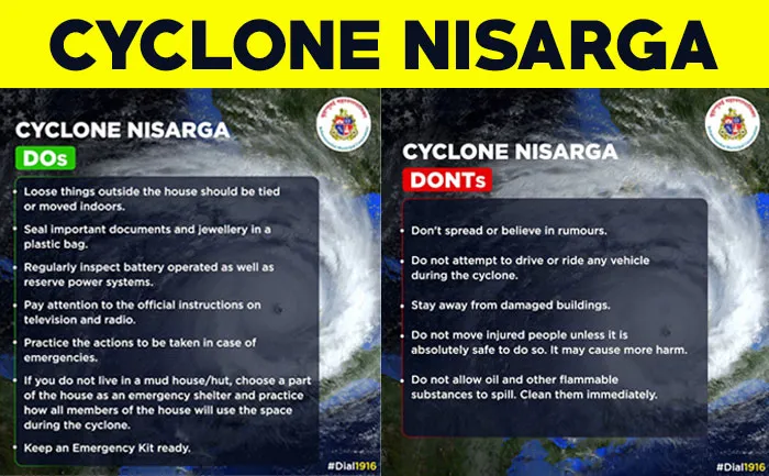
Maharashtra government has also issued a list of Dos and Don’ts ahead of cyclone Nisarga landfall. Check it here:
The cyclone will cross Maharashtra coast between Harihareshwar and Daman, very close to Alibag between 1pm and 4pm. While crossing the coast it will have strong winds of 100-120kmph. By midnight it will weaken & by tomorrow morning it will become depression.
8 units of NDRF and 5 units of Navy have been deployed at various locations in the city. NDRF has 1 team each in Colaba (Ward A), Worli (G/South), Bandra (H/East), Malad (P/South) & Borivali (R/North) & 3 teams in Andheri (K/West): BMC.
Also Read: NDRF gear up for Cyclone Nisarga, To Hit Alibaug Near Mumbai At Noon


